Creating Landscape Illustrations and Maps in Wales and South West England
Most people appreciate the human touch that hand drawing provides. My landscape illustrations and maps interpret historic aspects of the landscape, explain the present landscape, and give impressions of future development and change. Get in touch today to discover more about my illustration and mapping services throughout Wales and South West England.
Landscape Illustration Services
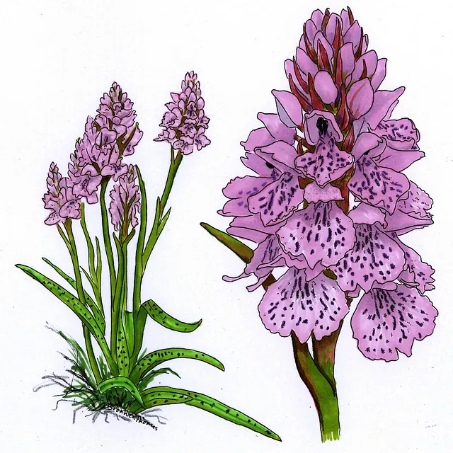
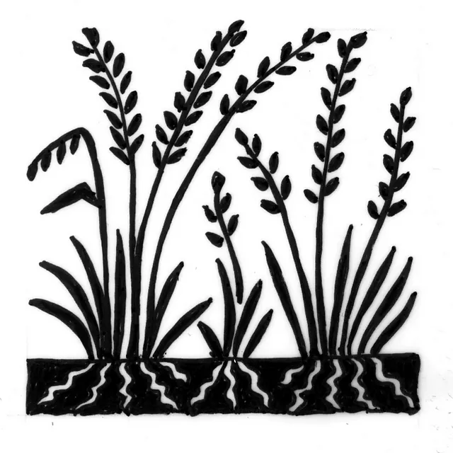
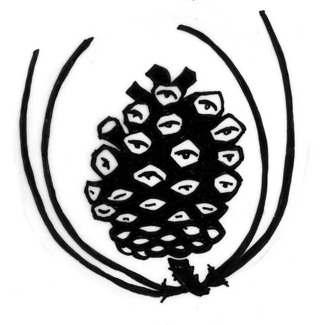
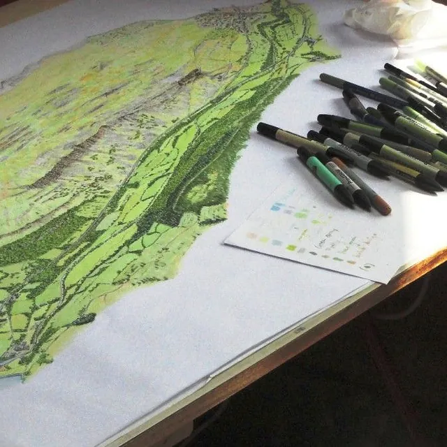
I have produced hand-drawn maps and illustrations in a professional capacity for many years. This is a good method to convey character and atmosphere, giving emphasis where required as well as being engaging to look at.
This has led to the development of specific styles, usually based on line drawings with colour washes. Using a bird’s-eye view has proven an excellent way to graphically put across concepts and information about the landscape and built environment and express a sense of place.
The success of these illustrations is founded on my thorough knowledge and appreciation of the landscape, gained by visits, research, and observations.
My illustrations are used for on-site interpretation panels, promotional literature, and book and website illustrations.
My Landscape Illustration Projects
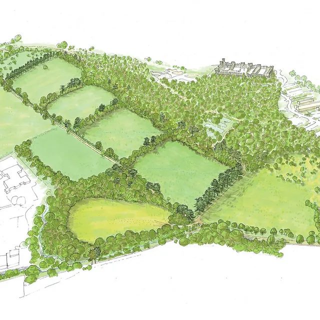
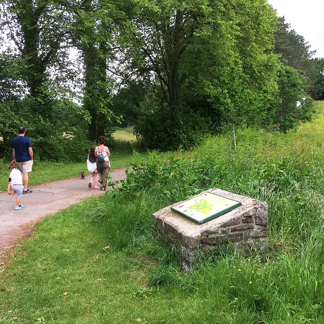
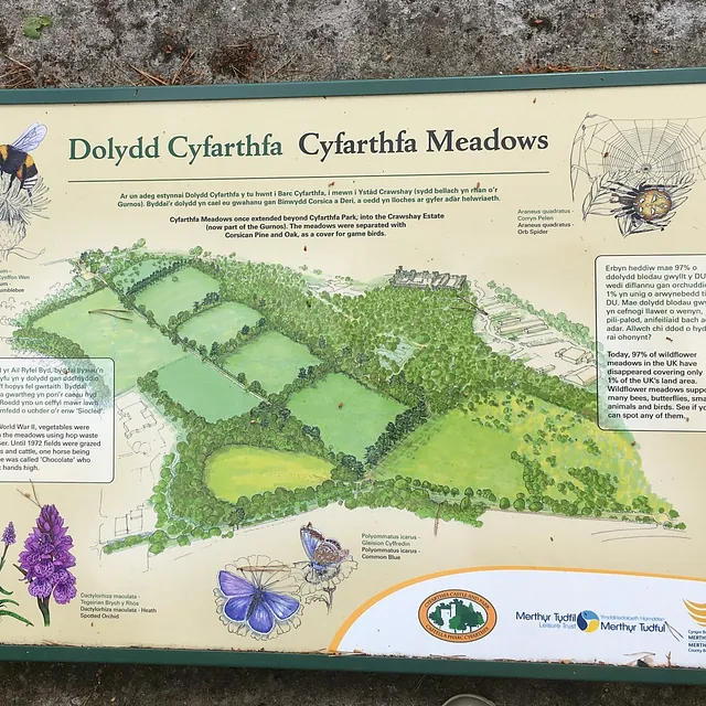
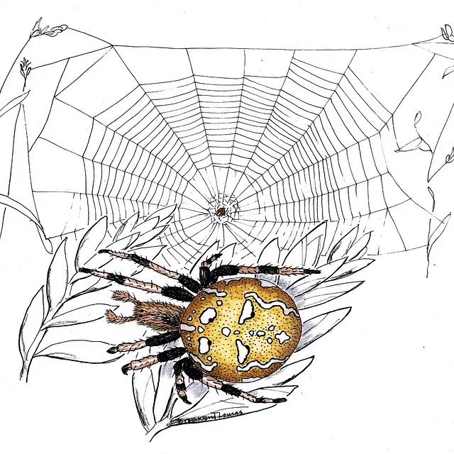
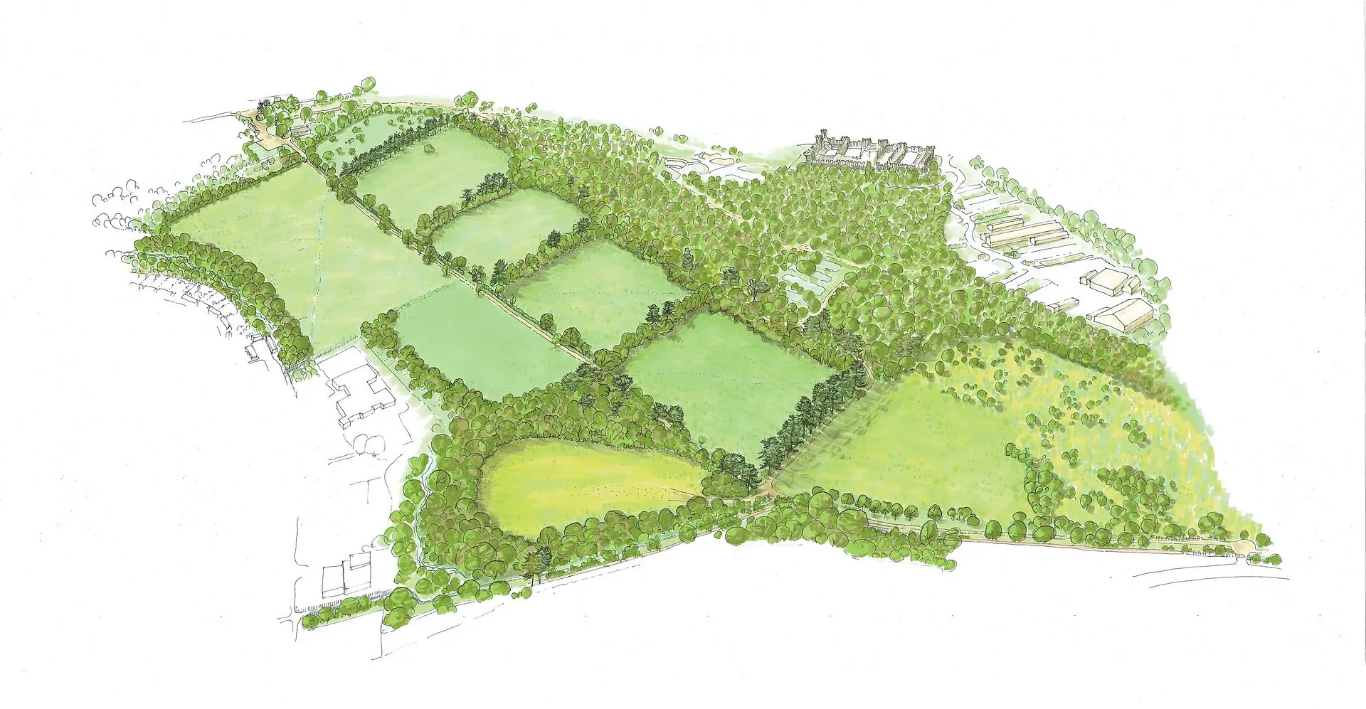
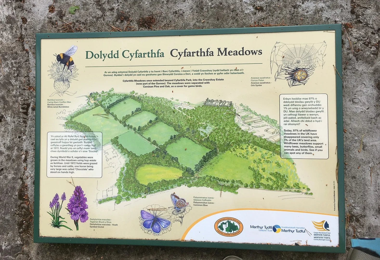
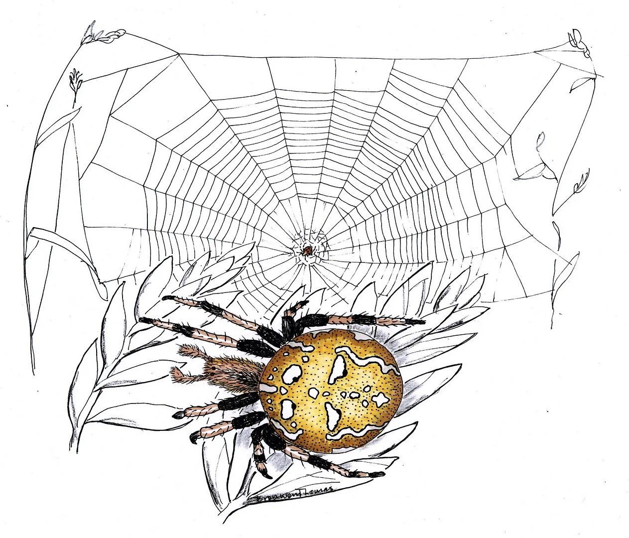
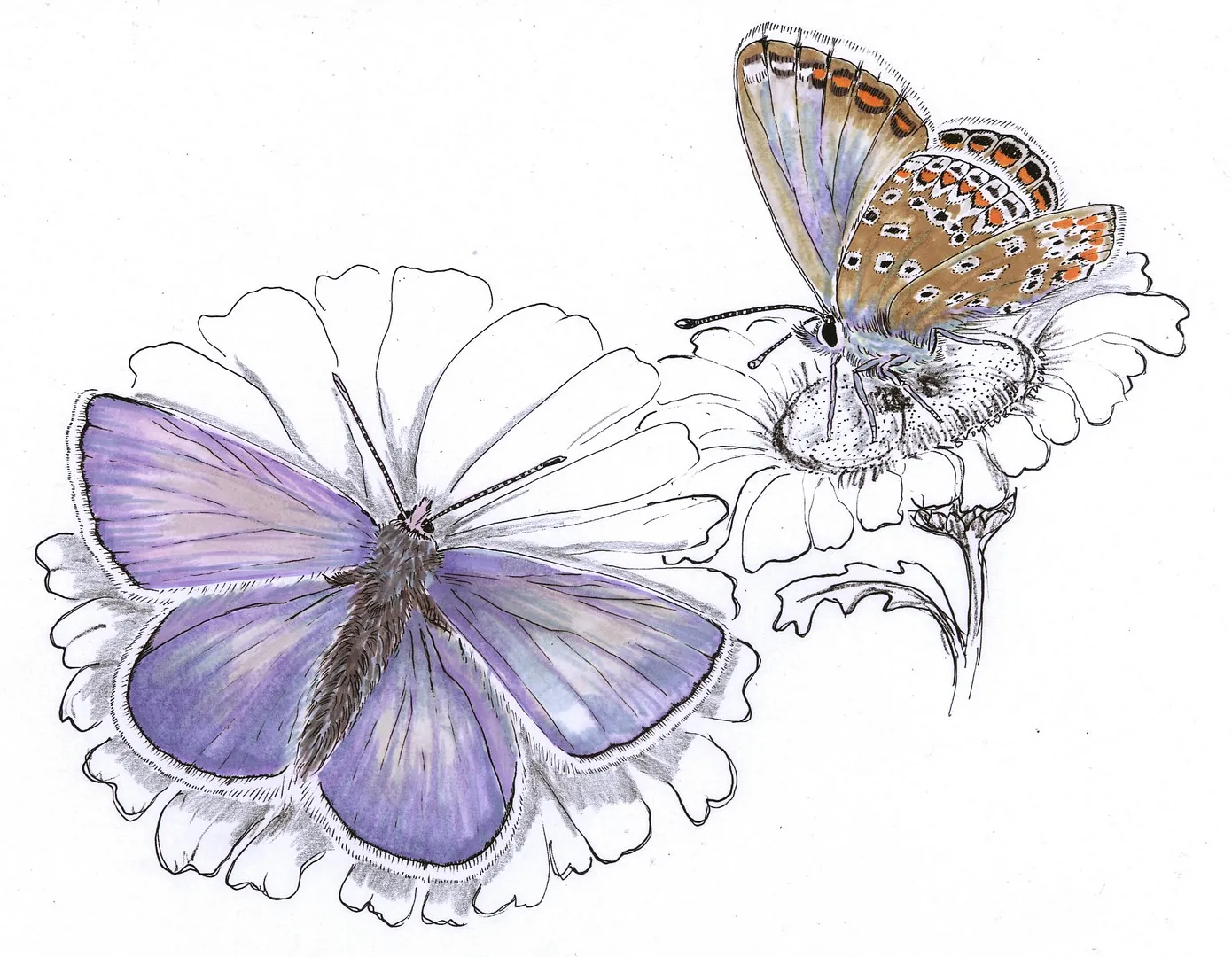
Cyfarthfa Meadows, Merthyr Tydfil
Client: Merthyr Tydfil County Borough Council
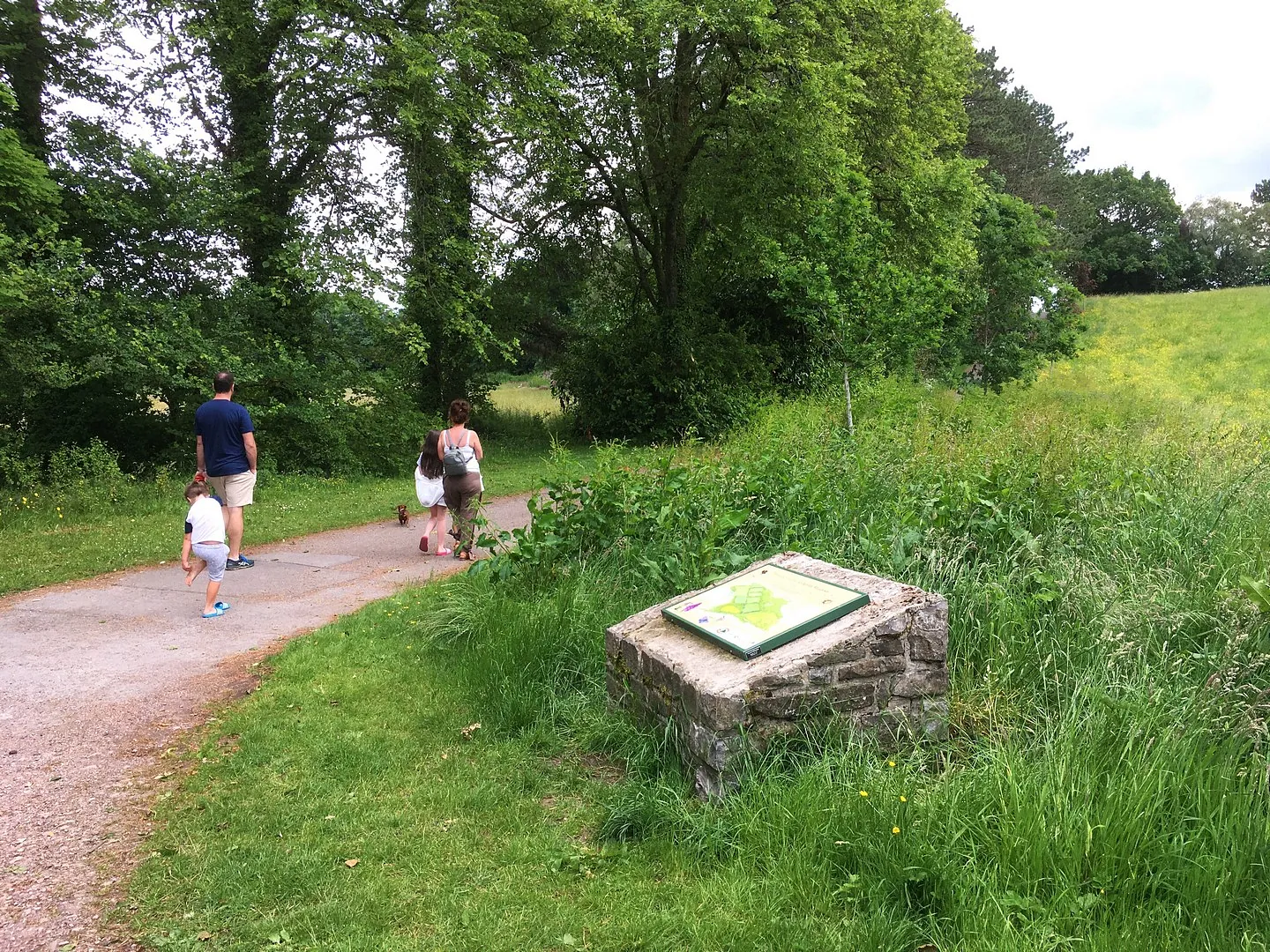
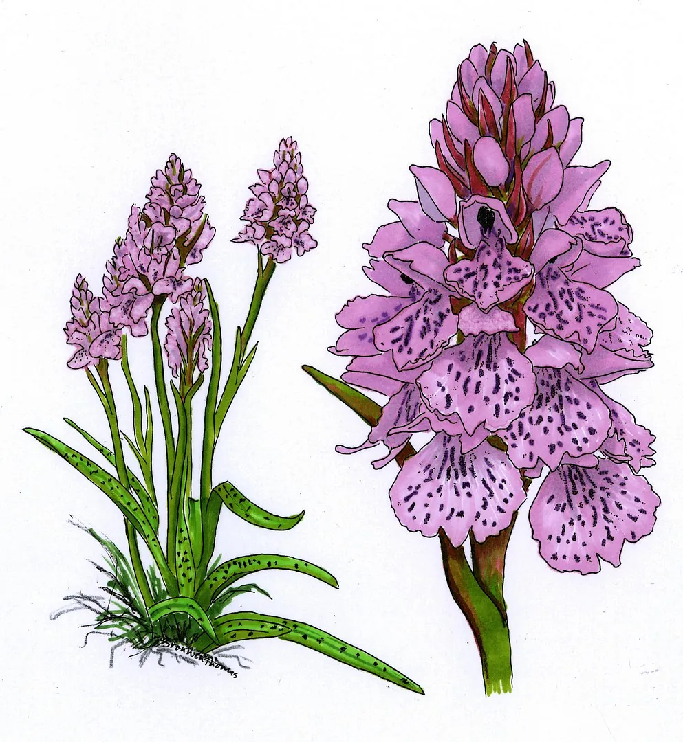
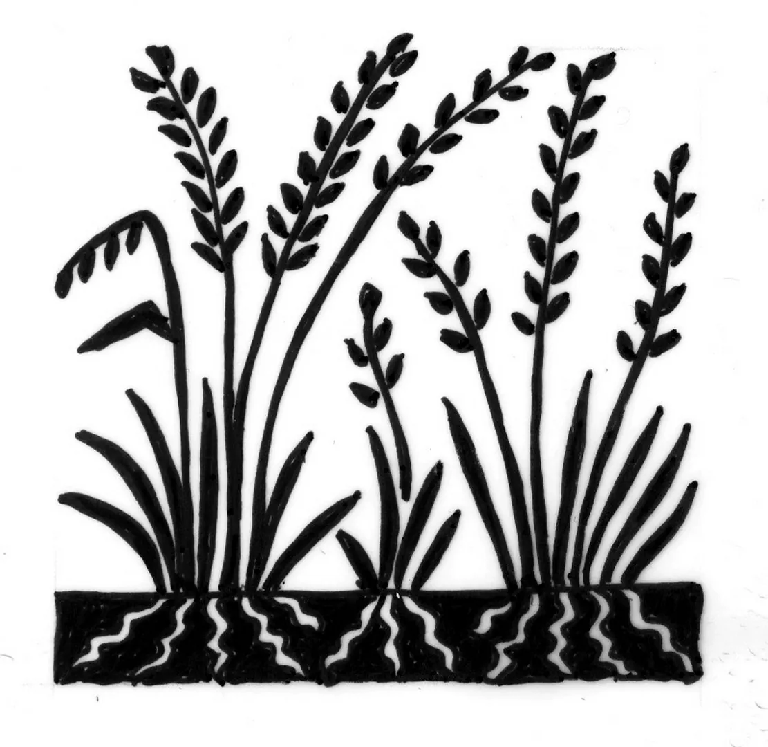
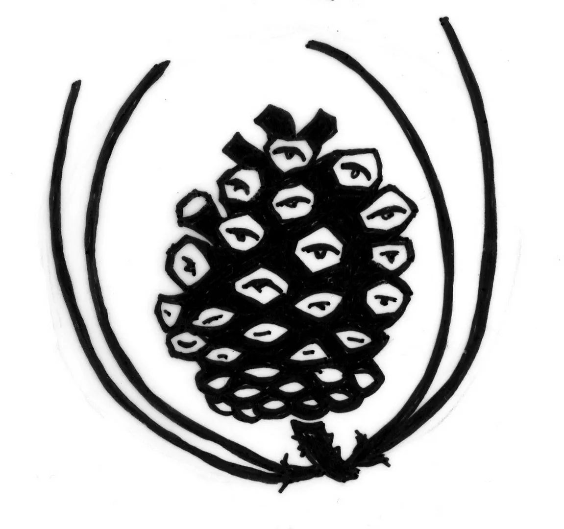
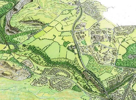
Above the historic Cyfarthfa Castle and Park, the Meadows is a biodiverse area of open fields on higher land. It is well-used by residents in nearby housing and affords fine views of the surrounding hills. I was commissioned to prepare a bird's eye view and a series of illustrations for interpretation boards, showing the extent and context of the Meadows and some of the interesting wildlife to be found there.
Project gallery
-
 Cyfarthfa Meadows, Merthyr Tydfil
 -
 Cyfarthfa Meadows, Merthyr Tydfil
 -
 Cyfarthfa Meadows, Merthyr Tydfil
 -
 Cyfarthfa Meadows, Merthyr Tydfil
 -
 Cyfarthfa Meadows, Merthyr Tydfil
 -
 Cyfarthfa Meadows, Merthyr Tydfil
 -
 Cyfarthfa Meadows, Merthyr Tydfil
 -
 Cyfarthfa Meadows, Merthyr Tydfil
 -
 Cyfarthfa Meadows, Merthyr Tydfil
 -
 Cyfarthfa Meadows, Merthyr Tydfil


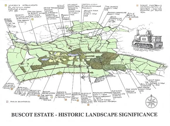
Buscot and Coleshill Estate, Wilts/Oxon/Glos – Illustrations for Visitor Interpretation
Client: The National Trust
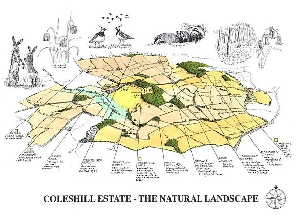
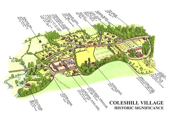
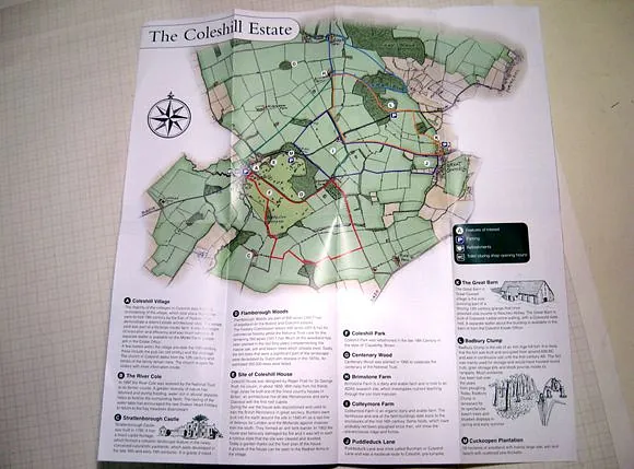
Adjacent to the Thames, the 7500-acre Buscot and Coleshill Estate includes 11 farms, woodland, 2 areas of historic parkland, and 5 villages.
Having previously prepared the Buscot and Coleshill landscape management plan, I have subsequently prepared a variety of illustrations for use in Northern Territory interpretation and education.
Work Produced
- 12 bird's-eye views of the landscape and villages, showing the significance of the historic landscape, the natural landscape, and the community
- various maps of the estate
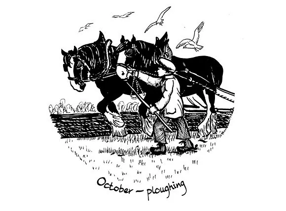
- series of roundels depicting the farm work carried out by children in the victorian era
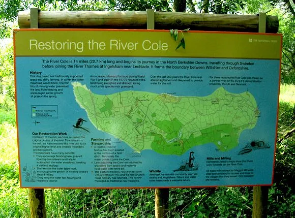
- map of the river cole with illustrations of the associated wildlife at coleshill mill
- cutaway overhead drawing of the biomass boiler at coleshill
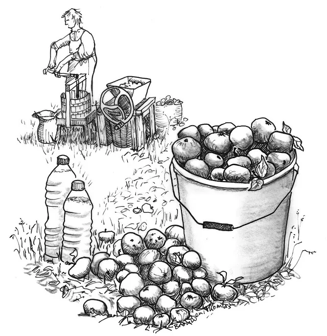
- bird's-eye views of the community orchards at coleshill
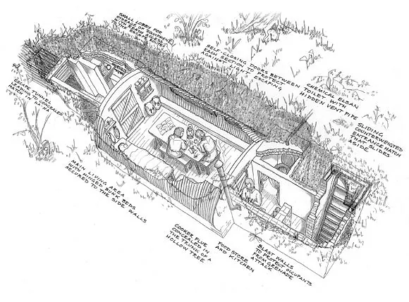
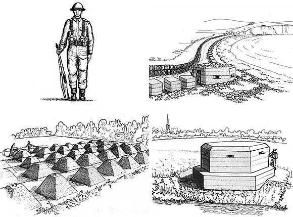
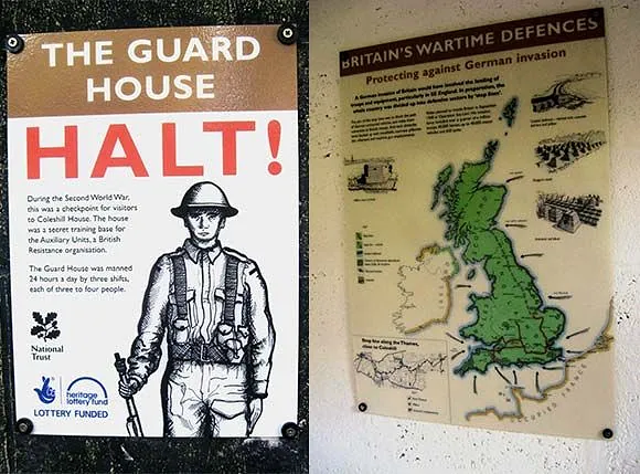
- cutaway overhead drawing of the WW2 underground bunker used for training ‘churchill’s underground army’
- drawings of a variety of defensive structures and a map of britain showing the stop lines
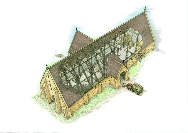
- cutaway overhead drawings of the medieval grange barn at great coxwell and associated illustrations
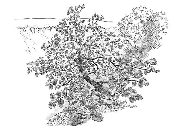
- bird's-eye view of the iron age hillfort in Its heyday at the now-wooded badbury hill (see image at the top of this page) and associated drawings
Project Gallery
-
 Buscot and Coleshill Estate, Wilts/Oxon/Glos, Illustrations for Visitor Interpretation
 -
 Buscot and Coleshill Estate, Wilts/Oxon/Glos, Illustrations for Visitor Interpretation
 -
 Buscot and Coleshill Estate, Wilts/Oxon/Glos, Illustrations for Visitor Interpretation
 -
 Buscot and Coleshill Estate, Wilts/Oxon/Glos, Illustrations for Visitor Interpretation
 -
 Buscot and Coleshill Estate, Wilts/Oxon/Glos, Illustrations for Visitor Interpretation
 -
 Buscot and Coleshill Estate, Wilts/Oxon/Glos, Illustrations for Visitor Interpretation
 -
 Buscot and Coleshill Estate, Wilts/Oxon/Glos, Illustrations for Visitor Interpretation
 -
 Buscot and Coleshill Estate, Wilts/Oxon/Glos, Illustrations for Visitor Interpretation
 -
 Buscot and Coleshill Estate, Wilts/Oxon/Glos, Illustrations for Visitor Interpretation
 -
 Buscot and Coleshill Estate, Wilts/Oxon/Glos, Illustrations for Visitor Interpretation
 -
 Buscot and Coleshill Estate, Wilts/Oxon/Glos, Illustrations for Visitor Interpretation


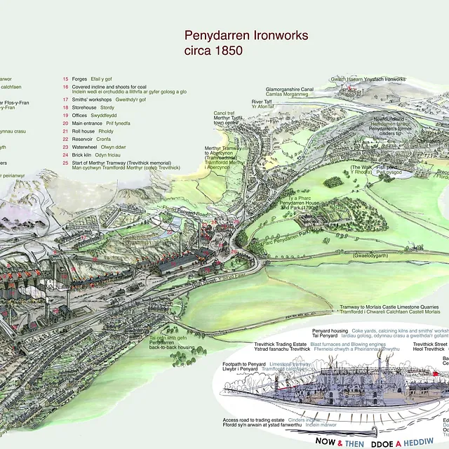
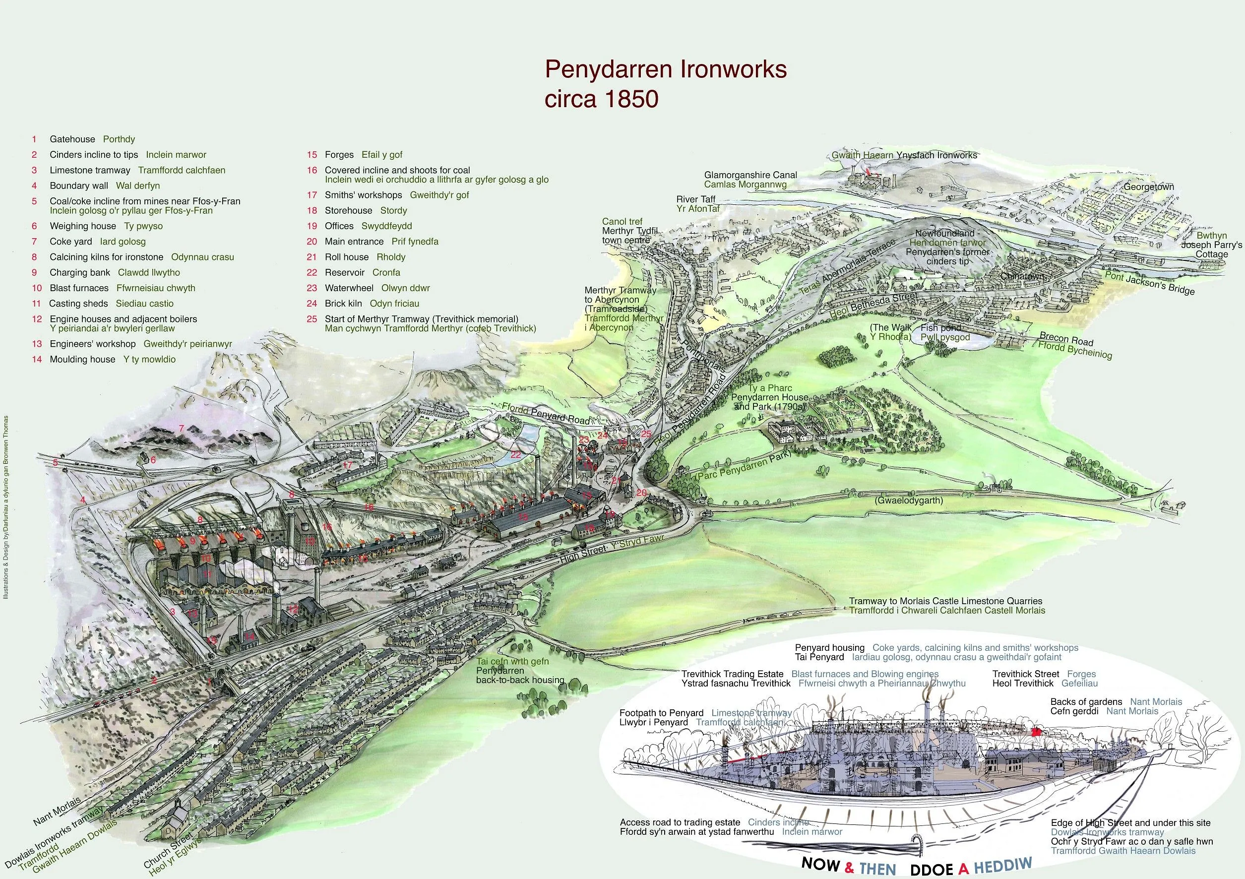
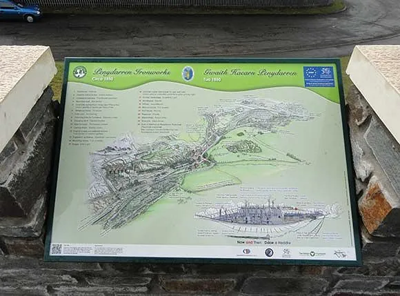
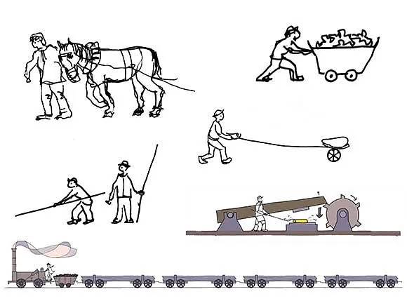
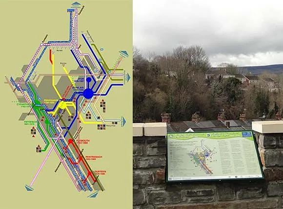
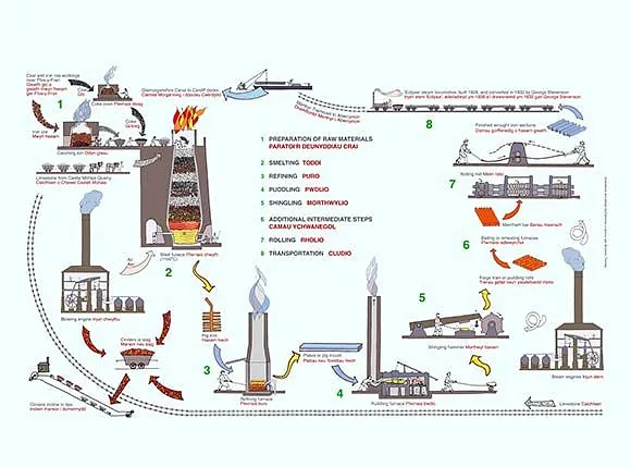
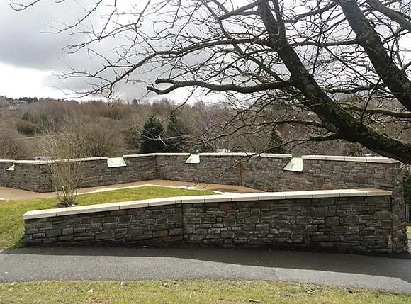
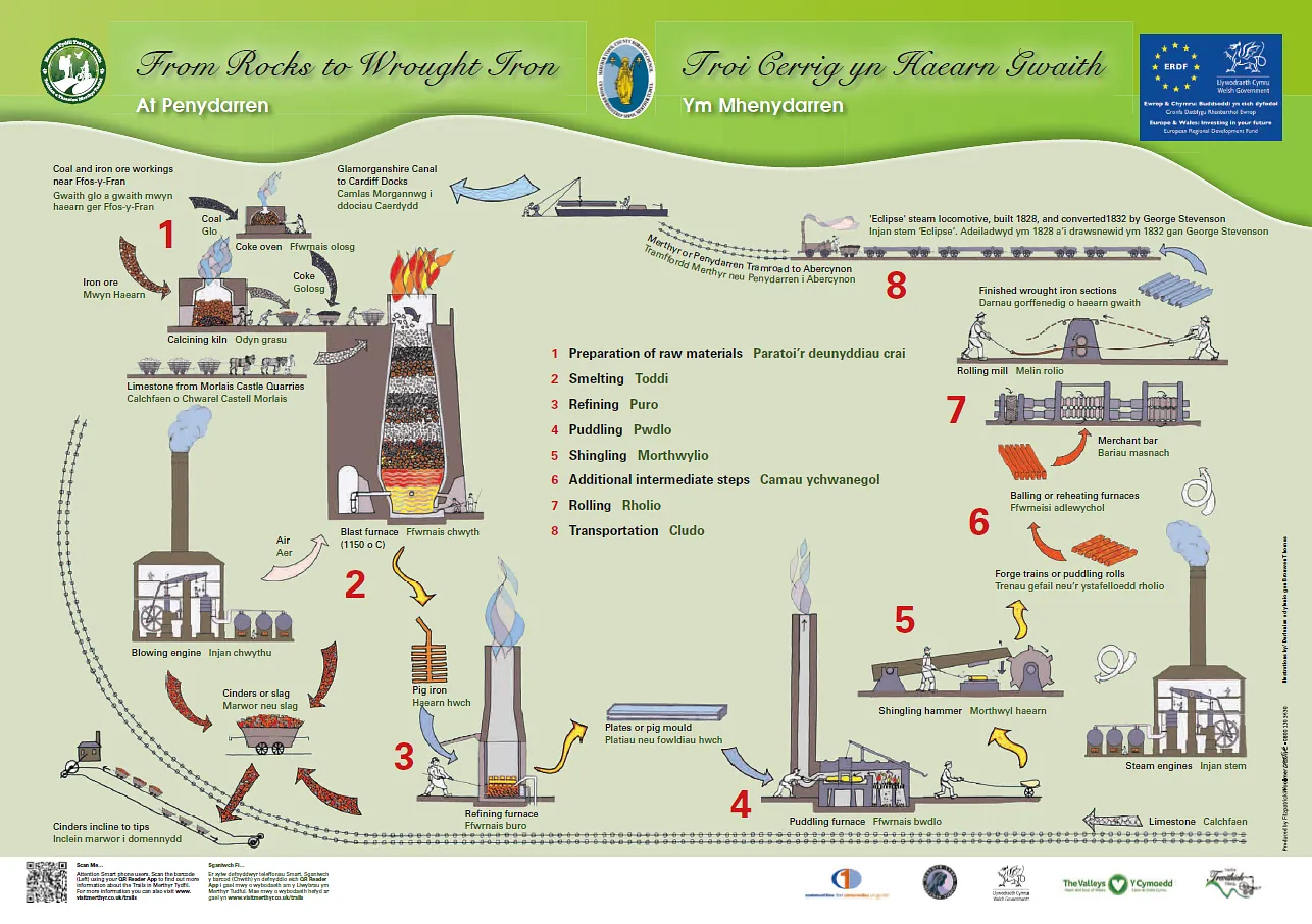
Penydarren Ironworks Interpretation Panels, Merthyr Tydfil
Client: Merthyr Tydfil County Borough Council
Hardly a trace remains today of the Penydarren Ironworks. Now, the Trevithick Trail follows the route of the world’s first passenger-carrying steam locomotive, starting at a viewing platform overlooking the site.
I produced the artwork and design for three panels set into the walls of the viewing platform. This involved carrying out research, gathering illustrations, maps, and texts to inform the illustrations, and investigating what little evidence remains on the ground. All illustrations were produced by hand and ink on tracing paper, then printed, coloured, scanned, and manipulated digitally.
Project gallery
-
 Penydarren Ironworks Interpretation Panels, Merthyr Tydfil
 -
 Penydarren Ironworks Interpretation Panels, Merthyr Tydfil
 -
 Penydarren Ironworks Interpretation Panels, Merthyr Tydfil
 -
 Penydarren Ironworks Interpretation Panels, Merthyr Tydfil
 -
 Penydarren Ironworks Interpretation Panels, Merthyr Tydfil
 -
 Penydarren Ironworks Interpretation Panels, Merthyr Tydfil
 -
 Penydarren Ironworks Interpretation Panels, Merthyr Tydfil
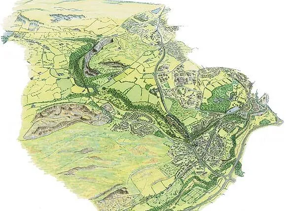
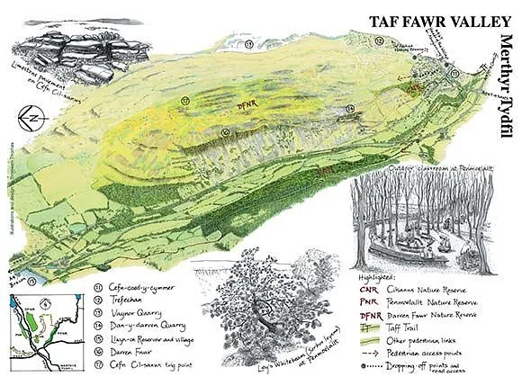
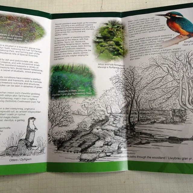
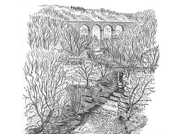
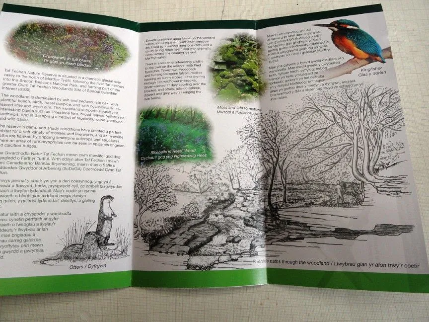
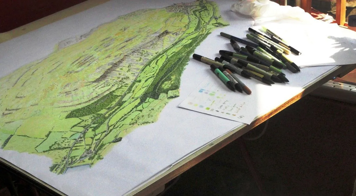
Illustrations for Various Interpretation Applications – Taf Fechan & Taf Fawr Valleys, Merthyr Tydfil
Clients: Merthyr Tydfil County Borough Council and Merthyr & District Naturalists Trust
The Taf Fawr and Taf Fechan rivers flow from the Brecon Beacons, cutting steep-sided valleys through limestone, to have their confluence at Merthyr Tydfil. As the A470, the main road north through Wales follows the Taf Fawr valley, it is familiar to many people. The Taf Fechan valley is more secluded although it’s within an easy walking distance of the centre of Merthyr Tydfil.
I was commissioned to produce a bird's-eye view of a 4-mile stretch of the Taf Fechan valley, showing the dramatic topography with many features of historic and industrial interest, wildlife sites, the Taff Trail, and other routes. This was followed by the commission to produce a similar bird's-eye view of the Taf Fawr valley, with additional pen and ink drawings showing details of special features within the valleys.
These drawings have been used for interpretation panels, large-scale display material, and the Taf Fechan Nature Reserve brochure.
Project Gallery
-
 Illustrations for Various Interpretation Applications, Taf Fechan & Taf Fawr Valleys, Merthyr Tydfil
 -
 Illustrations for Various Interpretation Applications, Taf Fechan & Taf Fawr Valleys, Merthyr Tydfil
 -
 Illustrations for Various Interpretation Applications, Taf Fechan & Taf Fawr Valleys, Merthyr Tydfil
 -
 Illustrations for Various Interpretation Applications, Taf Fechan & Taf Fawr Valleys, Merthyr Tydfil
 -
 Illustrations for Various Interpretation Applications, Taf Fechan & Taf Fawr Valleys, Merthyr Tydfil
 -
 Illustrations for Various Interpretation Applications, Taf Fechan & Taf Fawr Valleys, Merthyr Tydfil
 -
 Illustrations for Various Interpretation Applications, Taf Fechan & Taf Fawr Valleys, Merthyr Tydfil


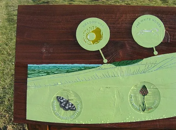
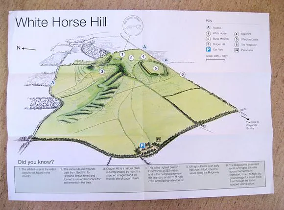
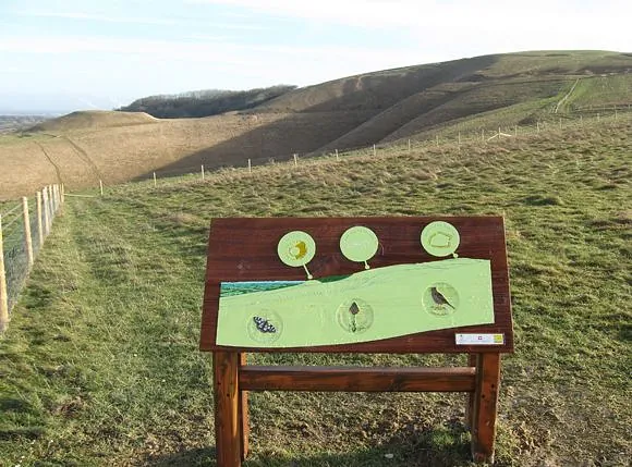
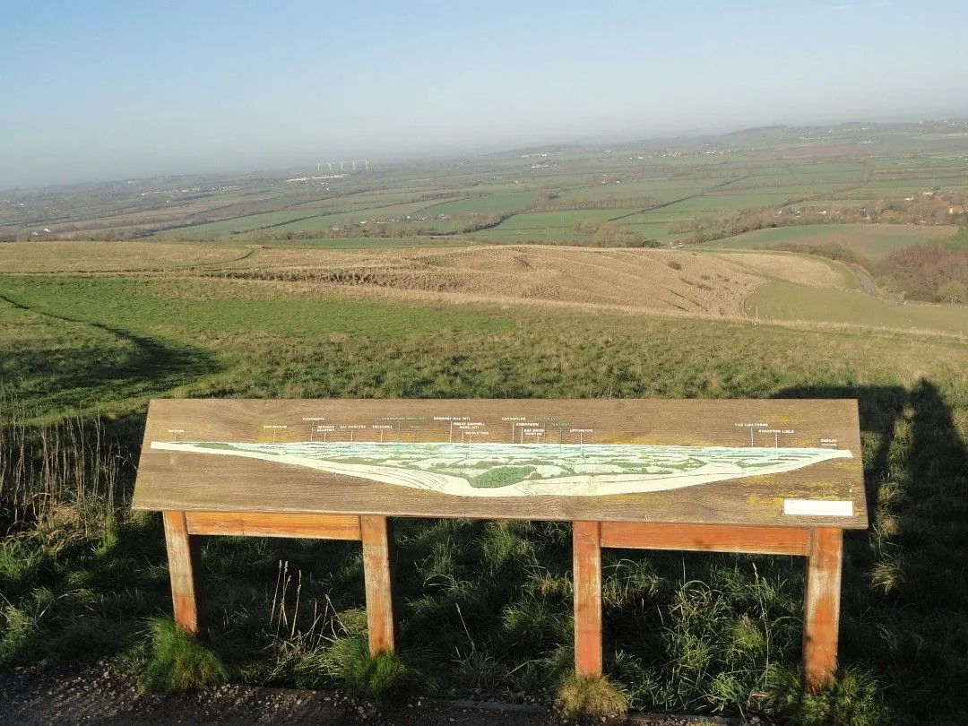
White Horse Hill, Uffington, Berkshire
Client: The National Trust, Thames and Chilterns Region
The wonderful enigmatic prehistoric White Horse, with other nearby ancient monuments, is on the escarpment of the Berkshire Downs looking out over the Vale of the White Horse.
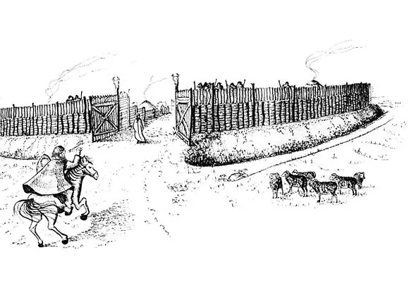
I was commissioned to prepare drawings for interpretation panels in the car parks. This included an illustration of Uffington Castle hillfort in its heyday, based on up-to-date archaeological evidence. A bird’s-eye view of the property has been used in the information leaflet.
Additional panels were designed to interpret the panoramic views from the escarpment and to show the White Horse and other features of interest. These were specifically designed for production as routed timber tactile panels for the visually impaired, with the views and features pared down into simple shapes while remaining recognisable.
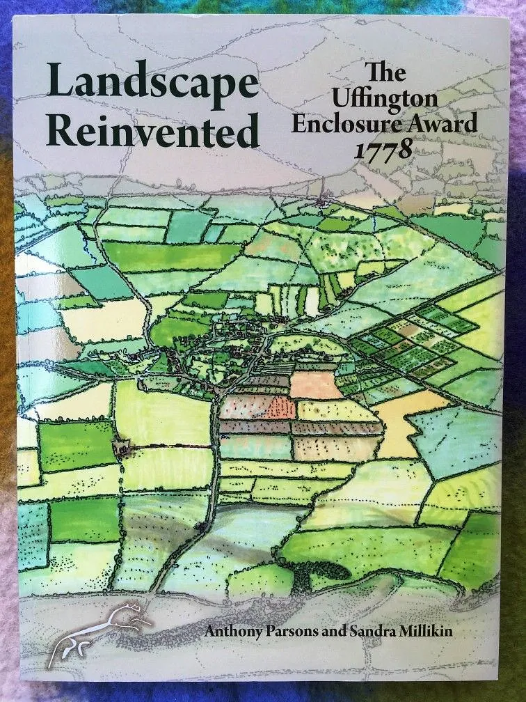
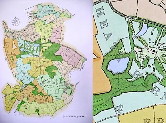
On the strength of these illustrations, I was commissioned by the authors of Landscape Reinvented: The Uffington Enclosure Award 1778 to prepare bird’s-eye views of the parish of Uffington before and after enclosure. These were used on the front cover and inside the book.
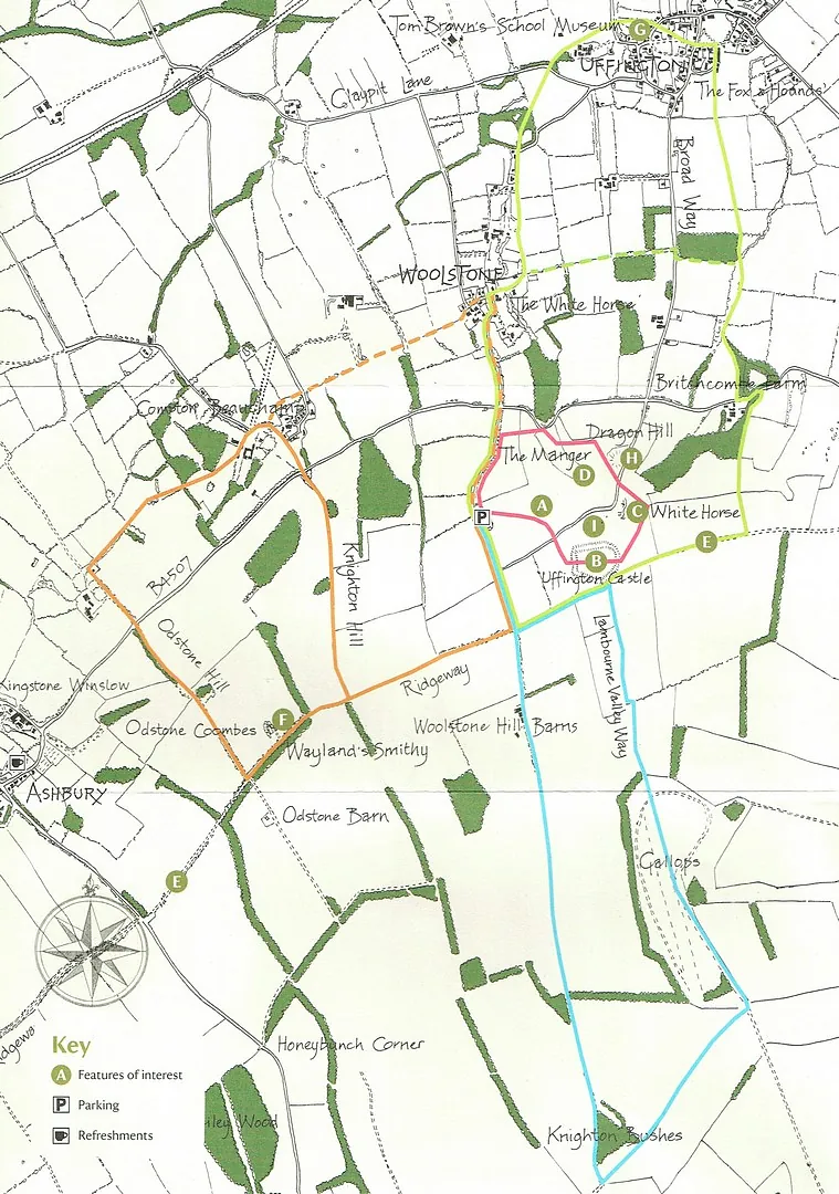
Since then, I have produced a map of the area, covering White Horse Hill, Ashdown House, and nearby farmland and villages for use in walks leaflets.